Canadian Great Divide Trail Log

Welcome to the archive of my trail journal for my 2016 walk of the Canadian Great Divide Trail.  =This undertaking was shared with my cousin River Taig and his dog Opus. Follow us along this 1200 km adventure through the Canadian Rockies.  

(note the journal starts in the middle and goes to the beginning)

Section E August 11

Section E August 11


We wrap up section E today. Only 11 km from the trail head we left the truck at back into jasper. Part of through hiking is doing all of the little pieces that connect the big parts of the trail together.  This small piece into jasper and then tomorrow's 20k out of jasper are good examples of this.  These haven't been my favorite parts of the trip but it's all about good style.  I would want to say well I walked all of the Canadian Rockies except for this 10 k piece.  But this gives us a chance to get the chores done.


Jasper is a tourist town. It's got everything a trail tried pair of hikers might want.  Beer, pizza, bakery, laundry and endless coffee from Tim Hortons.  As I'm writing this trail clothes are being washed and River is driving to Hinton to pick up Opus so that she can rejoin us on the trail now the we are out of the protected mountain caribou habitat.  Most of the caribou where killed in an avalanche leaving only three in one heard and perhaps a dozen in another.


Section E

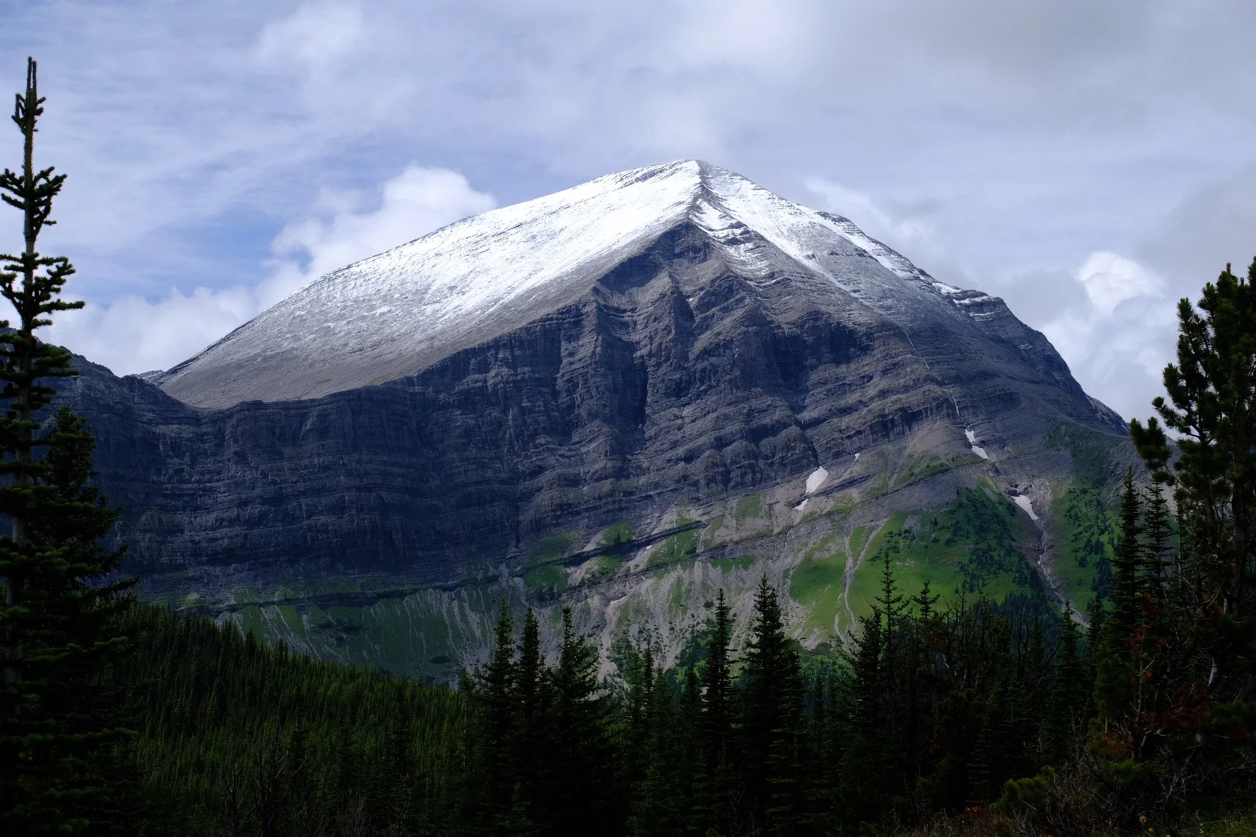
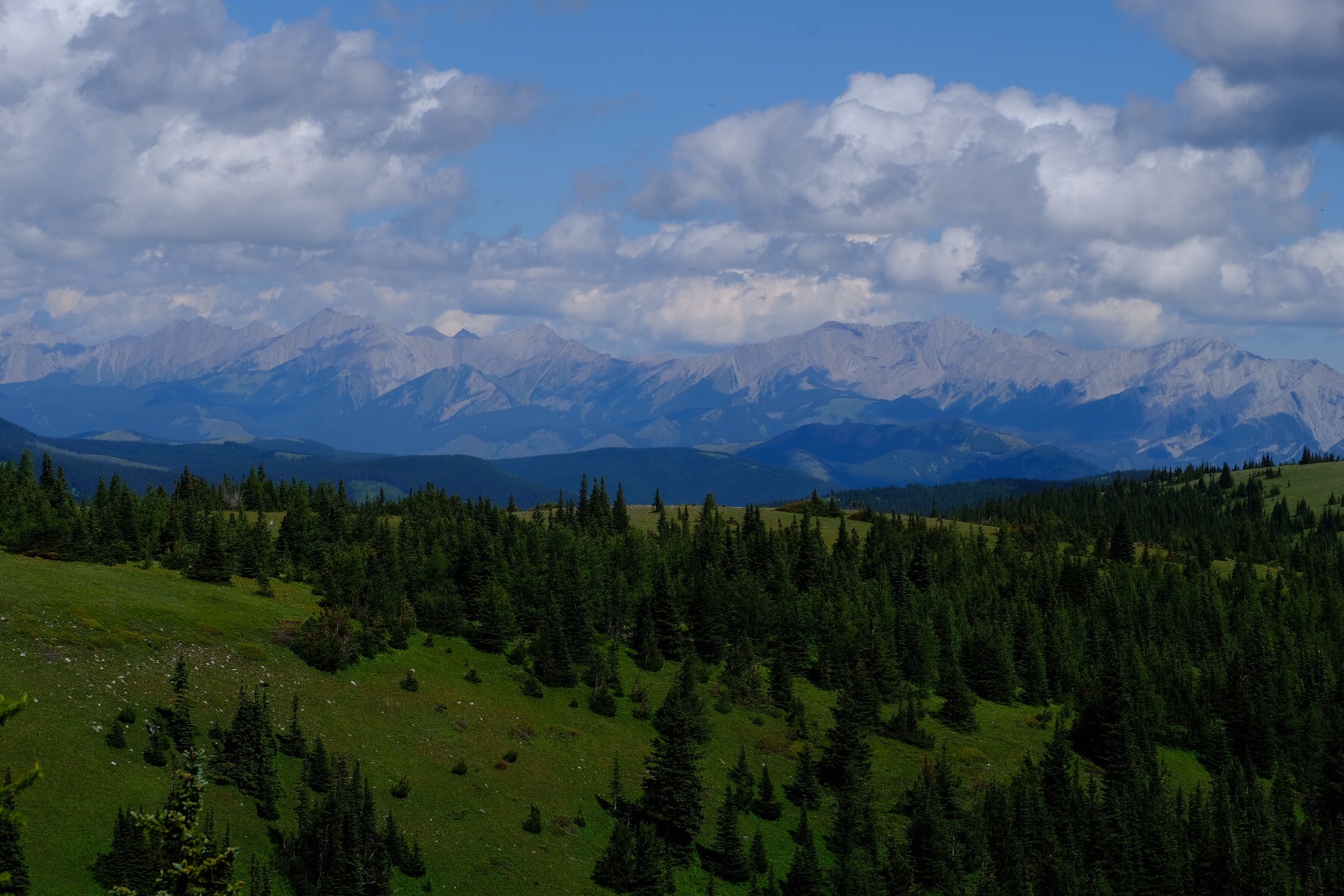
Up Owens River canyon over zinger and annalysse passes, to Michelle lakes, past pinto lake, up cataract creek, over cataract pass, follow the brazeau, head up four point creek, pause at Jonas pass, over Jonas shoulder, follow another river up another pass, keep going on decommissioned trail past old an campground at Mary Voax, keep heading northish to malingne lake and finally pickup the skyline trail into jasper.  This has been a big section and one of the most beautiful by far. Sleeping 50 meters away from four male big horn sheep might have been the highlight. But walking at the base of the clouds yesterday on the skyline was good too.  Or having my breath taken away as I walked up a rise to a nameless lake (now Opus lake) and seeing how perfectly blue its water was.


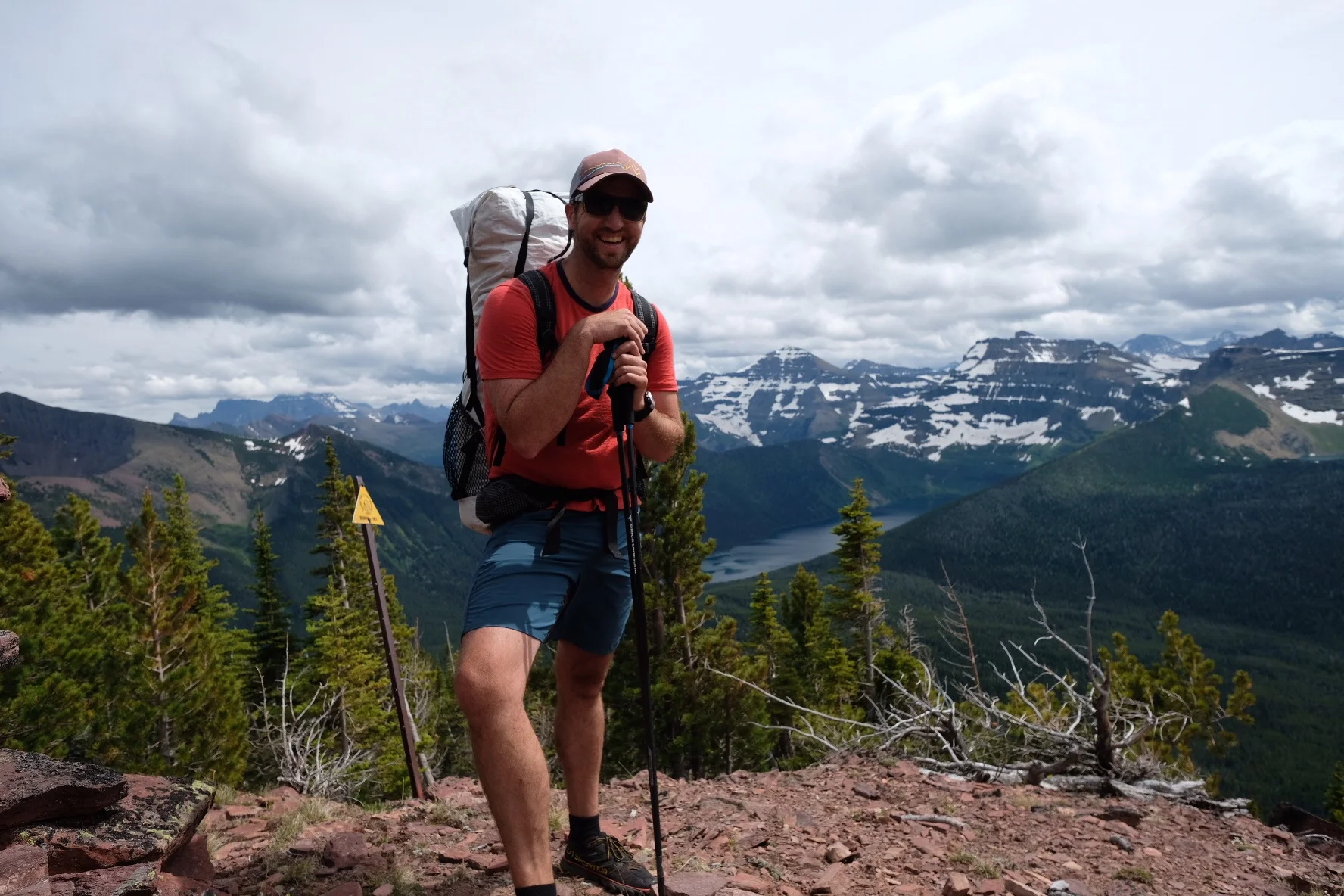
We had several rain events during the last week. Learning to take them in stride. We are doing a better job of pitching our lightweight tent now that we have some new pegs. My goretex jacket is taking beating. It stills keeps me mostly dry but is wetting out almost daily.  The new pair of runners I started section C with are mostly shot. Looking forward to something new on the feet. My pinky toe on the left foot is showing through.  One of Rivers shoes is about to be spilt in two. Otherwise the gear is holding up. My backpack is not shiny and white any longer. My camera is less beat up then I would have thought at this point. I did carry the tripod for the first 3 days of section E. I know 2.5lbs (1kilo) doesn't seem like much. But that is equally to 2.5 days worth of dinners.  It's been so nice to have a light pack. We keep seeing people out on the trail with monster packs. It looks so painful! I need to figure out how to pair down about 2 lbs for this next section.


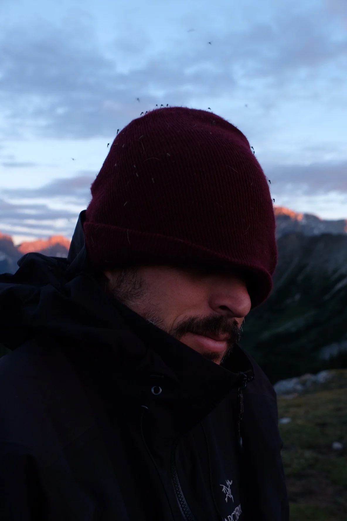
Feet are fine now. Walking 30-40k in a day just seems normal. It's weird to wake up after some sleep and be able to go again. Humans are good walkers. My beard is huge. Over a month and its needs some taming. However, it does keep the face warm in the chilly mountain wind and it keeps the mosquitos from getting close.


Going forward, the next step is always close by. We have two weeks of trail ahead of us. Section F and G. F takes us out of Jasper and up towards Mt. Robson, which is the tallest in Canada. We will be mostly on horse trails for the first and last bits. If the weather is good we will take a side trip to Ice berg lake to view Robson. For many GDT hikers The Robson visitors center marks the end of the trail. For us we will push further north to kakwa lake, another 170 kilometers north northwest.  We will resupply on the Holmes River road which is splat dab in the middle of nowhere.  Casting off from Jasper means two full weeks of committing trail. The chances of seeing other hikers outside of Iceberg lake are slim to none.  Once we reach The car on Holmes River Road we will drive back to jasper and pick up the second vehicle and position it at the end of the trail at kakwa lake.  From Holmes a River road we should be able to finish the 170k in 6 days, but will carry enough food for 7.


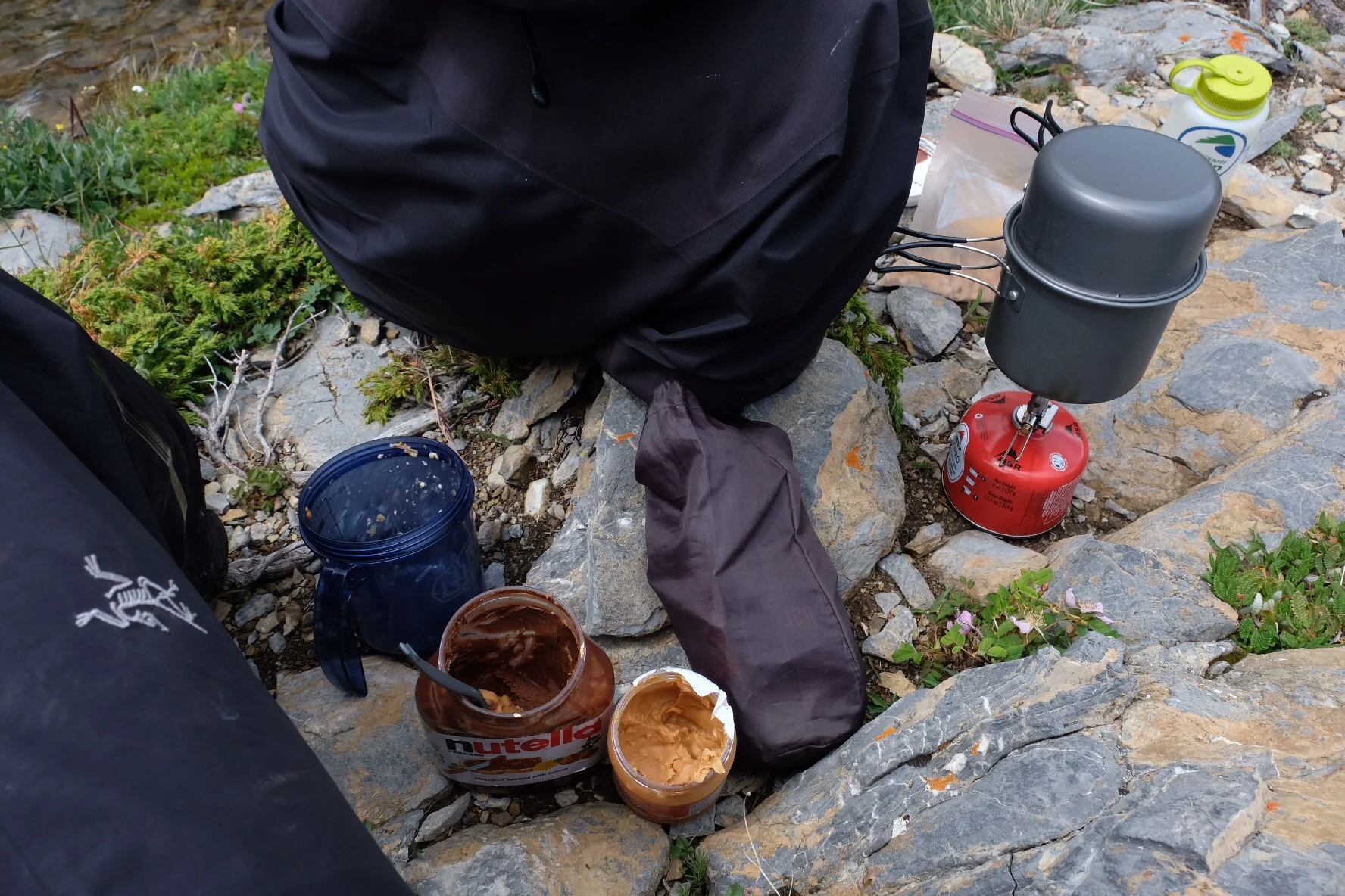
Food. I have never eaten so much! The other night we had ramen, instant potatoes, pad Thai and a veggie burrito bowl.  I decided to go veggie for all of our dinners since sharing favors makes more sense out here. I haven't missed the meat much at all. I'm curious to see if this will be a more permanent change in diet.  I think it might be. I feel plenty strong and I don't feel that I'm loosing any muscle mass.  I do crave fish. I'm happy keeping some salmon in my diet.


Check out the photos from the last few days.


image.jpg
image.jpg
Little color in the sunset  

Little color in the sunset  

An unnamed lake. Now Opus lake

An unnamed lake. Now Opus lake

Maligne pass

Maligne pass

Following the trail..... 

Following the trail..... 

Imagine that it rained last night.... 

Imagine that it rained last night.... 

Curator lake  

Curator lake  

Skyline trail  

Skyline trail  

Marmot

Marmot

Tekarra peak. Named after Tekarra who basically saved the David Thompson party from starving by killing a moose in the middle of winter.  

Tekarra peak. Named after Tekarra who basically saved the David Thompson party from starving by killing a moose in the middle of winter.  

image.jpg
This is the original end of the GDT just outside of Jasper.  Dustin lynx extended the route by 300 kilometers in the mid nineties.  Thanks Dustin for keeping the adventure going! 

This is the original end of the GDT just outside of Jasper.  Dustin lynx extended the route by 300 kilometers in the mid nineties.  Thanks Dustin for keeping the adventure going! 

Section C part one

In last five days we covered 125 kilometers in some magical alpine space.  My feet are improving. Drained a nasty infected blister while gazing up at Mt. Assiniboine so much happier!!! The weather is getting steadily better as we move into late July. The bugs are heavy. Apparently dry alpine ridges are a favorite for Canadian mosquitos. I've been bitten so many times now it just doesn't matter. Besides bug repellent attracts bears.  Which we did see two grizzly bears in section B. A rare and special occasion for sure. That encounter has given me much to think about. It is different not being the apex species in these woods.  


Overall I love it up here the scenery is nothing short of spectacular.  Our days are long but our legs are stronger. Enjoy!! 


image.jpg
mt Assiniboine lodge

mt Assiniboine lodge

image.jpg
amazing sunrise. Cant wait to work on this and print it Big!!! 

amazing sunrise. Cant wait to work on this and print it Big!!! 

image.jpg
image.jpg
image.jpg
Waiting out an afternoon thunderstorm at Sunshine loved outside of Banif  

Waiting out an afternoon thunderstorm at Sunshine loved outside of Banif  

image.jpg
image.jpg
image.jpg
image.jpg
image.jpg
image.jpg
image.jpg
image.jpg
image.jpg
image.jpg
River and Opus

River and Opus

image.jpg
image.jpg
the GDT eats shoes.... 

the GDT eats shoes.... 

Section B week II

Wet wild midlands of section B.  Overall great walking. We covered about 199 km. Going from the town of Coleman to Kananaskis country.  The weather improved in the last 2 days out of 7.  


Enjoy a a quick selection of photographs.  Today we start section C starting where we stopped and heading north to the Flow Lake trailhead  


image.jpg
image.jpg
image.jpg
image.jpg
image.jpg
image.jpg
image.jpg
image.jpg
image.jpg
image.jpg
image.jpg
image.jpg
image.jpg
image.jpg
image.jpg
image.jpg
image.jpg
image.jpg
image.jpg
image.jpg
image.jpg
image.jpg
image.jpg
image.jpg
image.jpg
image.jpg

Great Divide Trail Section A

Week one, section A is complete. According to River this is the most challenging section of the GDT. We did two alternates on this section; Cassina Ridge and Barnaby Ridge.  With these two alternates this last week could really be summed up as the Skywalker Section. We where at or above tree line for most of the week. This afforded us great views but also meant that we got hammered by the weather. It rained 5 out of our 7 days. Having soaked feet simply became normal. Putting one cold wet socks and shoes was just part of the morning routine.   I know that our total elevation gain on day 5 was around 5000 feet.  On day 2 we climbed 2000 feet in a little less then a mile.  This climb followed a "cut line" up the slope right on the BC / AB border.  The cut line includes a swamp, brush, swarms of Hungary misquotes and no trail what so ever. However the reward is to be on top of Cassina ridge with views of alpine wonderland in all directions.  

Barnaby ridge was just stellar. From the top of La Corressete you have to make a choice of either climbing two more peaks to reach a saddle and then drop into the West Castle River valley or to head north to a committing 18 km ridge route. This route just looks awesome and frankly it is as full value as it looks. For an afternoon and a full morning we Skywalked the rigde line. Things only got dicey when we got hit hard by a late evening thunderstorm that just kept going until the early hours of the morning.  Navigating up there requires patience, perseverance, and to be one with the fact less then a meter to your right is a thousand foot cliff.  After getting beaten up by wind, rain, a ton of uphill, and some brush we where rewarded with a great trial out of South Forks Lake.  Barnaby Ridge would be an awesome hike to do in reverse with a light pack. I would forward come back for that. 

We have a four legged friend along on this trip. Opus is almost two years old and is quickly learning what it means to be a dog of both the trail and of the mountains.  It was interesting to watch her gain confidence daily and to start making her own choices when navigating obstacles. 

River and I have always been close. He is my big older cousin that I have always looked up to and held in very high regard. I can remember him packing for one of his early trips out on the PCT; I was about eight and he was eighteen or nineteen.  He picked me up in Washington and brought me down to Eugene to do an overnight backpack with our dads when I was no more then nine or ten.  He was the first one to take me rock climbing at the columns. I'm super stoked to be here with him sharing this adventure, getting to know each other more closely and to be able to tap into each other's strengths to make our journey even more successful.  Remember, this is his third time to be on the Great Divide.. I believe it says so much about the trails beauty if he is willing to come back again and again.  

X-Pro 2 all of the following photos are directly off the Pro 2 processed in camera and then spit over to the iPad as jpeg. The X-Pro 2 is a remarkable camera, it is so much camera in my hand yet it is small and nibble.  I'm using the 14mm and the 18-135 primarily I brought the 27mm pancake but it is going to not come with me on the next section. Over the week I used about 1.5 batteries and shot over 700 frames which far exceeds the specs from Fuji. I'm going to carry 3 batteries for section B. I'm missing a tripod about 3 times per week I brought the tiny Really Right Stuff pod with me. Is about 11oz with the plate on the camera. I used it a few times not really sure it was worth it.  I'm glad I switched out to the x-pro 2 over the X-e2 I'm loving the optical range finder function, super fast processor, bigger controls and better battery performance. 


Goat Haunt border patrol  

Goat Haunt border patrol  

Jump over to Canada  

Jump over to Canada  


Big horn sheep on day 3  

Big horn sheep on day 3  

Stellar mountain weather up on Cassina Ridge. Middle of nowhere didn't expect to find a flag...

Stellar mountain weather up on Cassina Ridge. Middle of nowhere didn't expect to find a flag...

image.jpg
image.jpg
image.jpg
La Coulete Peak

La Coulete Peak

Sky walking on Barnaby Ridge. Day 5 wet morning  

Sky walking on Barnaby Ridge. Day 5 wet morning  

Water fall coming from the South Forks Lakes

Water fall coming from the South Forks Lakes

Grouse

Grouse

image.jpg
Walking out Willoughby Ridge. Divide in the background.  

Walking out Willoughby Ridge. Divide in the background.  

Day 3? Skywalking  

Day 3? Skywalking  

Snow melting out. Ice bergs

Snow melting out. Ice bergs

Lunch time

Lunch time

Day 2 still looking clean on the top of Mt Roe.  The key to big climbs just keep smiling and laughing. It took us two hours to complete the Cutline.  

Day 2 still looking clean on the top of Mt Roe.  The key to big climbs just keep smiling and laughing. It took us two hours to complete the Cutline.  

Crypt Lake Trail

July 5 crypt lake trail. Waterton Lake

10.2 mile /14km 2300 feet of gain


Excellent trail, worth doing. Not one of my top ten all time hikes


Good parts - tunnel cable section and having to take a ferry across the lake.

Best part was the spring coming out of the hole in the rock which then pours over a 600 foot waterfall.  The fall isn't completely vertical.

Snow patches up at the top of the lake.  Ended at 6400 feet.

Opus did great. She was the only pup on the trip.

She needed a bit of help at the ladder and one spot on the cable

The ladder is 4th class with an exposed drop off climbers right. It's about 3 meters max

Cable is easy 3rd or 4th class. Probably 3rd but exposed


Take a ferry across the lake

Take a ferry across the lake

The tunnel  

The tunnel  

The ladder

The ladder

Ladder and tunnel  

Ladder and tunnel  

Big glacial valley  

Big glacial valley  

The drop on the 600 foot waterfall  

The drop on the 600 foot waterfall  

Crypt Lake. The USA is at the far end of the lake.  

Crypt Lake. The USA is at the far end of the lake.  

image.jpg
Waterton Lake with the wind blowing in my face.  

Waterton Lake with the wind blowing in my face.